
15 more seismic stations will be installed in various parts of Sabah, with 5 stations planned to be built on Mount Kinabalu. The stations will be in place by the end of 2016 as part of a move to improve earthquake monitoring activities in the state.
Science, Technology, and Innovation Minister Datuk Seri Wilfred Tangau explained that the stations will be located at the west coast (Kota Belud, Tamparuli, Kota Marudu), central area (Tenom district), and east coast (Lahad Datu, Beluran, Kinabatangan).
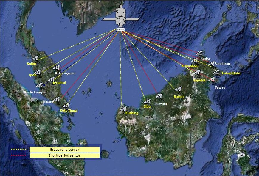
The seismic monitoring systems will be able to pick up movements on Mount Kinabalu and relay the data to the centre, either at the headquarters in Kota Kinabalu or any other location.
The main operations centre will also be upgraded as part of the improvements. Currently, 13 seismic stations are being monitored by the Meteorological Services Department.
The additional stations are needed as there is still a possibility of a major earthquake in Sabah, especially in Ranau and Lahad Datu, where a magnitude 6.2 earthquake was recorded in 1976. The earthquake was the largest one recorded in Malaysia, but it caused less extensive damages compared to the Sabah earthquake in 2015.
On further earthquakes in Mount Kinabalu, Universiti Malaysia Sabah geologist Dr Felix Tongkul said:
It is unlikely (…) because much of the energy within the FAULT LINES there were released in the magnitude 6.1 temblor a year ago.
Although it’s been a year since the Sabah earthquake, the effects of it continue to be felt by locals. Boulders, soil, and plants that were dislodged along the slopes during the earthquake washed into the rivers, causing water levels at Sungai Mesilou, Sungai Kedamaian, and Sungai Penataran to remain low.
It affects the villagers as the aforementioned rivers are key water sources for them. Mud floods at rivers along Mount Kinabalu’s foothills are also a regular occurrence nowadays.
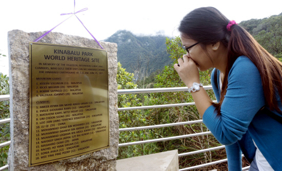
A monument was also erected in Kundasang in memory of the 18 who perished. The monument was built of granite stones that came crushing down during the earthquake.
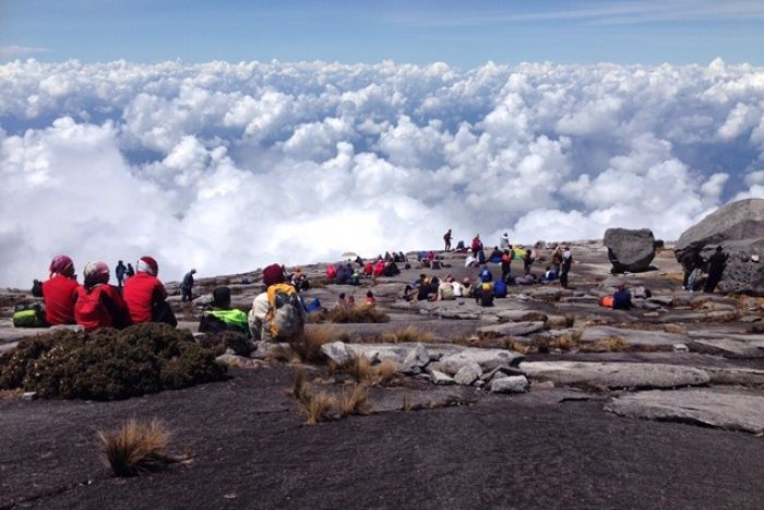
The 2015 Sabah earthquake measured 5.9 on the Richter scale and damaged the iconic “Donkey Ears” peak of Mount Kinabalu. The epicentre was 16 km northwest of Ranau but tremors could be felt in Kundasang, Tambunan, Interior, Tuaran, Kota Kinabalu, and Kota Belud.
Sources: The Star Online, The Sun Daily, Daily Express.
Follow us on Instagram, Facebook or Telegram for more updates and breaking news.