
In their quest to build the most comprehensive, accurate, and usable map of the world, Google Maps has announced that they’re adding the very first underwater panoramic images to their product.
To capture amazing imageries, Google has partnered with The Catlin Seaview Survey, a major scientific study of the world’s reefs. Using a specially designed underwater camera, the SVII, underwater locations are now made accessible to the millions of people that are already using Google Maps every day.

With these vibrant and stunning snapshots of the underwater world you can “swim” among colorful coral reefs and get up close with its inhabitants. With this underwater imagery, you don’t have to be a scuba diver (or even know how to swim) to explore and experience six of the world’s most incredible underwater spots, including reefs in Australia, the Philippines, and Hawaii.
Now, anyone can become the next digital Jacques Cousteau!
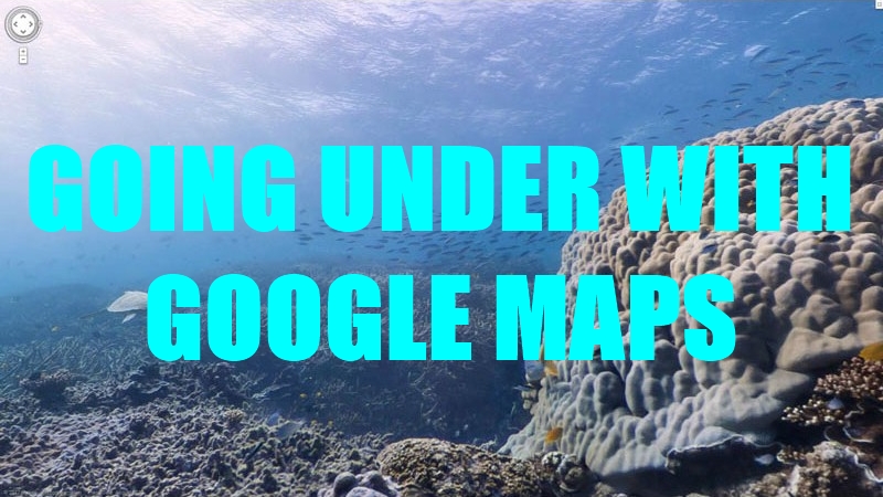
At the Great Barrier Reef, a UNESCO world heritage site, you can find a sea turtle swimming among a school of fish, follow a manta ray through the ocean and experience the reef at sunset.


You can also find out much more about this reef via the World Wonders Project, a website that brings modern and ancient world heritage sites online.
At Apo Island, a volcanic island in the Philippines, you can swim through a marine reserve where you can see impressive hard coral structures. And halfway across the Pacific, in Hawaii, you can join snorkelers in Hanauma Bay and drift over the vast coral reef in the Molokini Crater.

Sounds like hours of fun, huh?
Whether you’re a marine biologist, an avid scuba diver or a landlocked landlubber, you can now dive in and explore the ocean with Google Maps. And you can always explore more imagery from around the world by visiting this website.
Follow us on Instagram, Facebook or Telegram for more updates and breaking news.